
Country-Wide GIS Compilation — Partnership with Natural Resources Canada
To create a unified, digital bedrock map of Canada by combining and standardizing all federal, provincial and territorial datasets, to support country-wide target generation and mineral exploration.
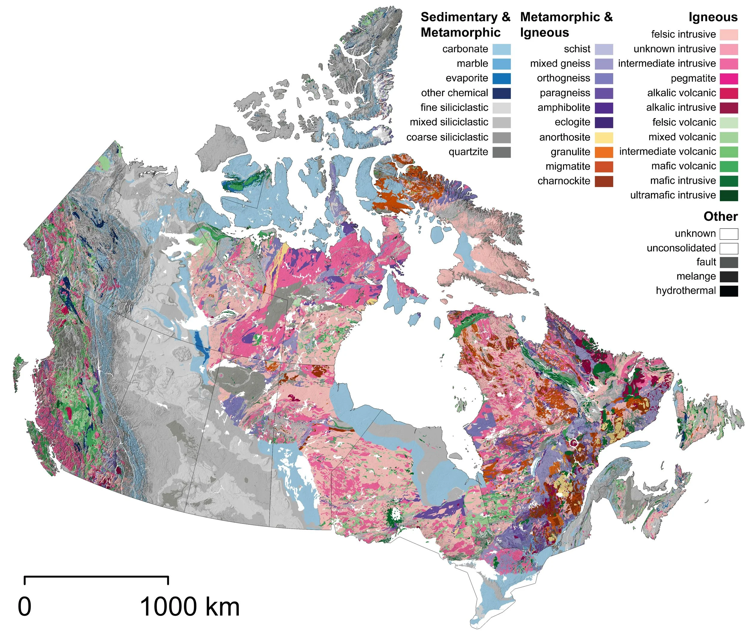
THE OPPORTUNITY
Combining 32 complex provincial, territorial and federal datasets requiring stitching, integrating and standardizing of lithological units across jurisdictional borders.
THE CHALLENGE
Leveraging our multidisciplinary team of geologists, geomatics specialists, and data scientists, Orix collaborated closely with the Geological Survey of Canada (GSC) to lead the data transformation. Using Python- and R-based automation, spatial analytics, and natural language processing (NLP), we cleaned, corrected, and merged attribute data across hundreds of thousands of polygons. Topological and spatial analyses were applied to fix geometry errors, resolve overlaps, and align coordinate systems, ensuring seamless cross-border integration.
THE ORIX SOLUTION
A unified, country-wide digital bedrock compilation at scales from 1:30,000 to 1:5,000,000—now publicly available for mineral prospectivity modeling and future exploration.